


Turn any set of plans into a bid-ready takeoff in minutes
Upload PDF blueprints, architectural drawings, or spec sheets and let Ottermap auto-detect scope, calibrate scale, and generate accurate quantities — for any trade, on any job.
 Get your first blueprint takeoff free
 No credit card required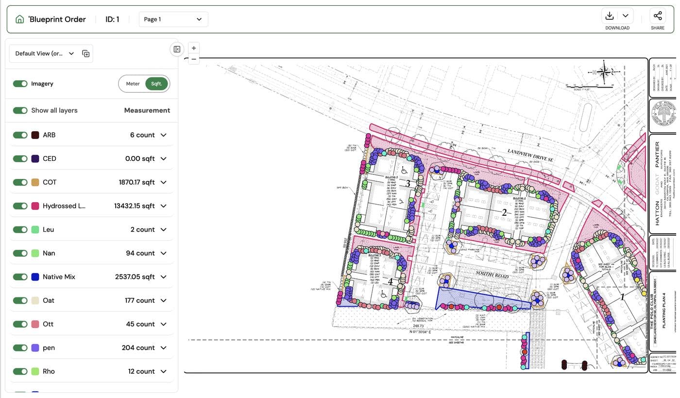
Built for general contractors and subcontractors across every trade
Blueprints shouldn't cost you a day of estimating
Scaling rulers, printed plan sets, and spreadsheets slow every bid down — and one missed detail on page 14 can cost you the job.
Every plan set has a different scale, orientation, and revision. Measuring by hand across dozens of sheets eats hours estimators don't have.
Ottermap auto-detects scale from the title block and calibrates every sheet automatically.
A detail buried in a legend or a revision cloud on sheet 9 can throw off an entire bid — and by the time it's caught, the job is already priced.
Layered takeoffs flag every callout, legend item, and revision so nothing slips through.
Paving, concrete, fencing, and sitework crews often re-derive quantities from the same drawings independently, wasting time and creating inconsistent numbers.
One shared, editable takeoff per project keeps every trade working from the same numbers.
Multi-sheet, multi-phase projects and portfolio bids turn into a filing problem before they're even an estimating problem.
Bulk upload and organize hundreds of sheets across phases, revisions, and sites in one dashboard.
From PDF to priced takeoff in four steps
Upload your plans
Drop in PDF blueprints, architectural drawings, spec sheets, or legends — single sheet or full set.
Auto-calibrate scale
Ottermap reads the title block and scale bar to calibrate every sheet, no manual ruler work required.
Review AI-generated quantities
Areas, lines, and counts are detected automatically by layer and trade — edit, relabel, or add notes in a click.
Export and bid
Send branded, exportable takeoffs to your estimating software, CRM, or straight into a proposal.
Built for plan sets, not just parcels
Everything from Ottermap's aerial takeoff tools, purpose-built for blueprint and construction-document workflows.
Any plan format
Upload multi-page PDF plan sets, scanned drawings, or CAD exports — Ottermap handles them all in one project.
Automatic scale calibration
No manual ruler-setting. Ottermap detects scale bars and title-block data to calibrate every sheet automatically.
Layered, trade-specific takeoffs
Separate layers for paving, concrete, fencing, utilities, and sitework so every trade sees only what's relevant.
Revision tracking
See what changed between plan revisions so re-bids and change orders don't mean starting over.
Team collaboration
Multiple estimators can work the same plan set with role-based permissions, comments, and shared notes.
Export anywhere
Push finished takeoffs to PDF, Excel, your CRM, or estimating software — white-labeled with your branding.
One takeoff tool for every GC and subcontractor on the job
Win more bids with plan-accurate numbers

Precision that wins contracts
- Quantities pulled straight from the plan set, not estimated by eye
- Consistent numbers across every trade and estimator
- Fewer change orders from missed scope

Speed without the overhead
- Full plan sets processed in minutes, not days
- No manual scaling or ruler work
- Bid more jobs with the same estimating team

Built for how you already work
- Works alongside Ottermap's aerial and parcel takeoffs
- No GIS or CAD experience required
- Mobile and desktop access for field and office

Support that scales with you
- Free onboarding for your estimating team
- White-labeled exports with your branding
- Responsive support as your bid volume grows
The platform is exceptionally user-friendly. The detailed maps have significantly improved our operational workflow, saving time and enhancing productivity. Plus, the support team is highly responsive and professional, always there to help whenever I’ve had a question or listen to any feature implementation ideas from my team.

Ottermap has been great for our company! Their accuracy and speed for site maps are like none other. Any suggestions for how to make our experience better have been taken into consideration and implemented thoroughly.

The system is so detail with the information needed and provided. The team listens to and tries to address any concerns and questions you have. Great team and great program!

OtterMap has been a game-changer for our business! The platform is incredibly user-friendly, making site mapping effortless and efficient. It’s saved us time, boosted productivity, and the responsive support team is always ready to help. Highly recommend it!

Stop scaling plans by hand
Upload your first blueprint and get a takeoff back in minutes — free, no credit card required.


